12.2 Karst Landscapes, Landforms, and Surface Features
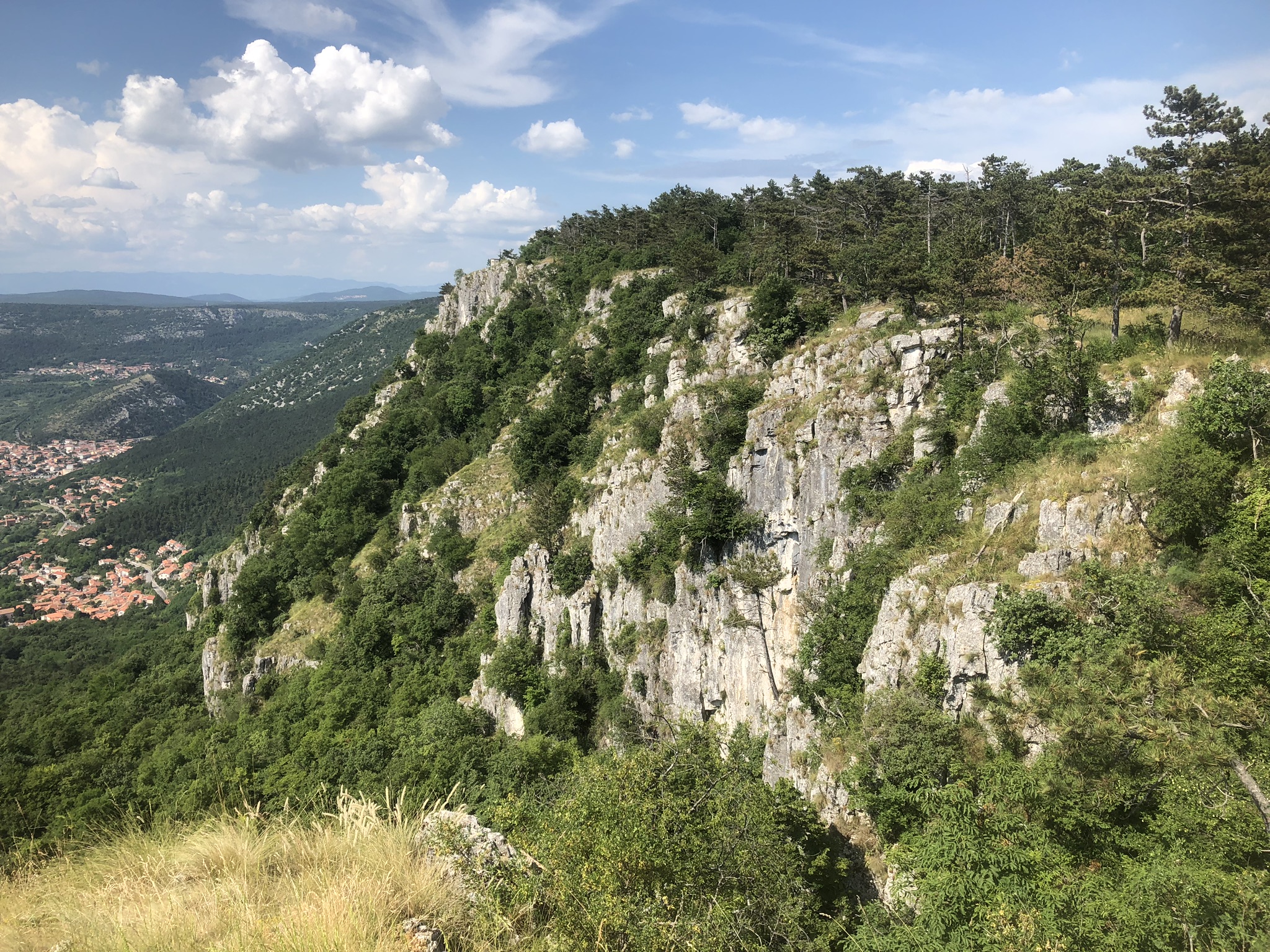
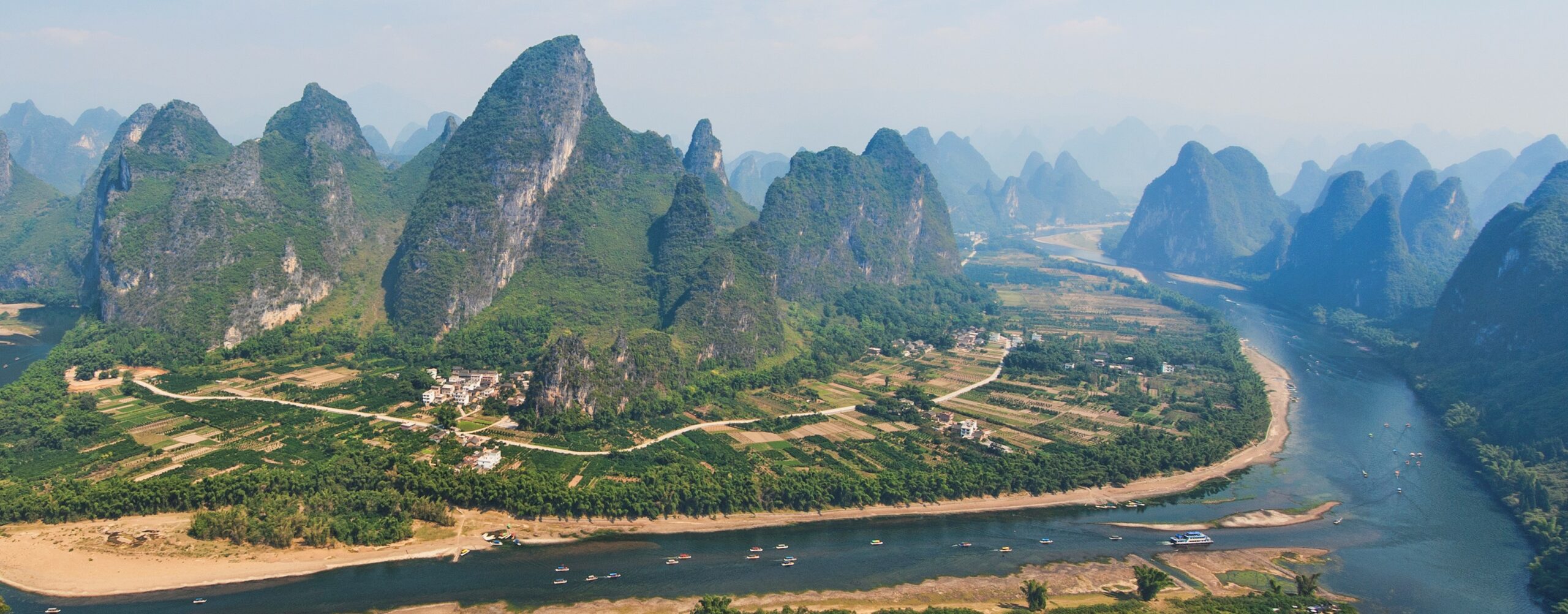
The characteristics of karst landscapes vary depending on factors such as: soluble bedrock type, climatic environment (more specifically precipitation and temperature), geographic position (both globally and locally), overlying soil materials, and vegetation cover (Figure 12.2.1). For example, in BC a variety of karst landscapes over a range of different climatic, geologic, and geomorphic settings such as: shoreline karst along the coast, forested karst at low and mid elevations, covered karst in the interior of BC, and alpine karst at high elevations on the coast and the Rockies.[1] Many of these karst landscapes have their own inherent ecosystems. There are also different karst landscapes in other climatic regions, such as in tropics where there is tower karst in China, cockpit karst in Jamaica and cone karst of Cuba. Other types of karst landscapes also occur in the arctic and desert environments. The characteristics of karst landscapes may not always represent present day conditions and could have developed under different climate, geomorphic, soil cover, and vegetation conditions—processes not in evidence today.
Karst Surface Features
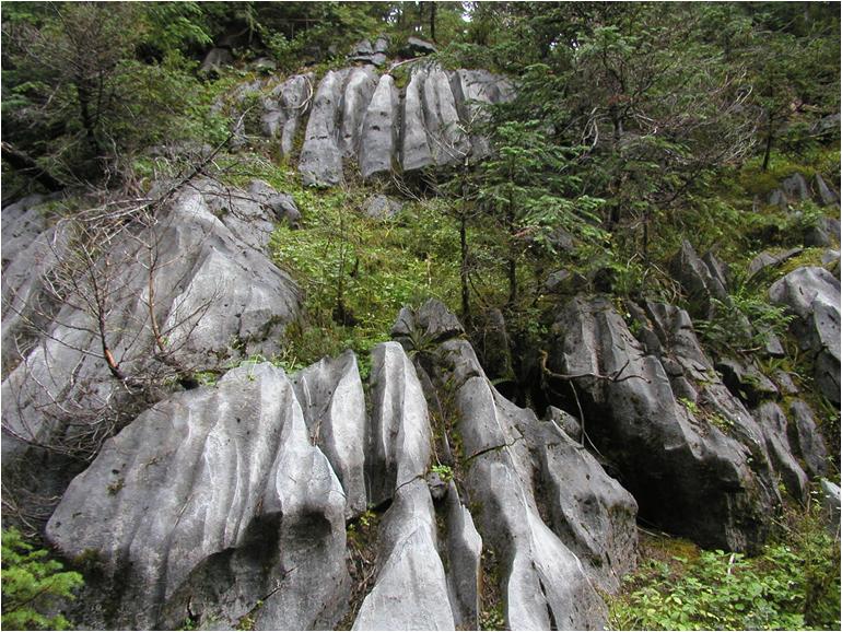
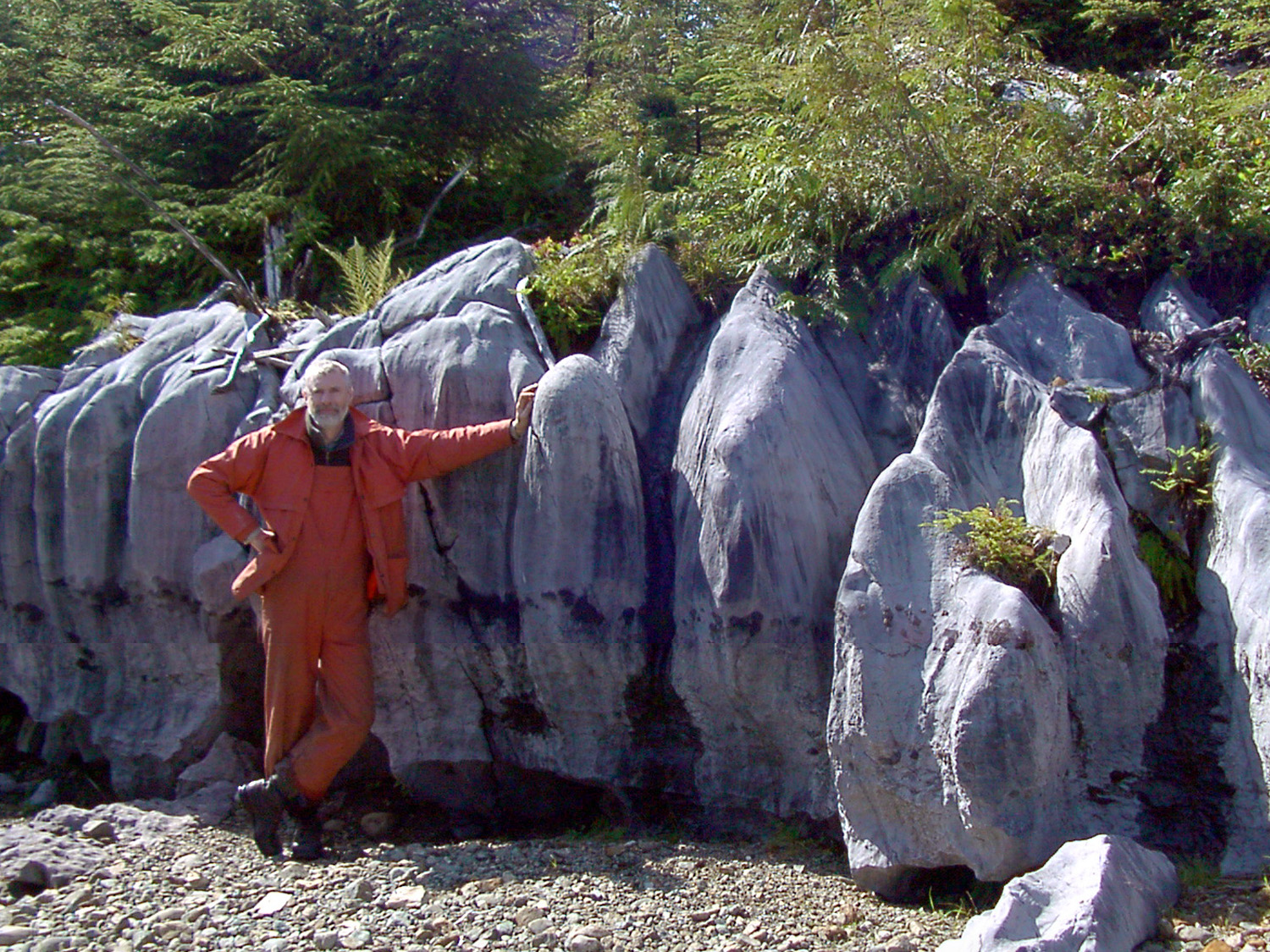
Most small-scale karst features of a karst landscape (mm to cm in size) are associated with linear channels, furrows or grooves that form on soluble rock outcrops or rock faces, particularly limestone. These features are collectively called karren (a German term) and this term is used to describe the complex array of solutional forms and patterns generally found on limestone surfaces. There is a vast array of karren types that have been classified, based primarily on their morphological characteristics and sizes. Some examples include: rillenkarren (shallow channels with sharp ridges 2-3 cm apart), rundkarren (rounded channels separated by rounded ridges), rinnenkarren (flat bottom grooves a few cm’s deep), and spitzkarren (large groves extending down steep spires) (Figure 12.2.3).
Identifying and classifying the larger-scale surface karst features is just as confusing as the smaller-scale surface karst features. In most cases karst feature classification is based on morphological characteristics (shape and dimensions) rather than their genetic origin. However, in some cases the function (e.g., input/output of water and air) of karst features is also used as part of the classification. Examples of some of the most common surface karst features encountered are as follows:
- Sinkhole – a topographically closed depression that is circular or elliptical in shape and with steep to vertical sidewalls. (Also called a ‘doline’ in European texts),
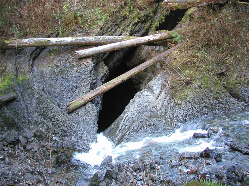
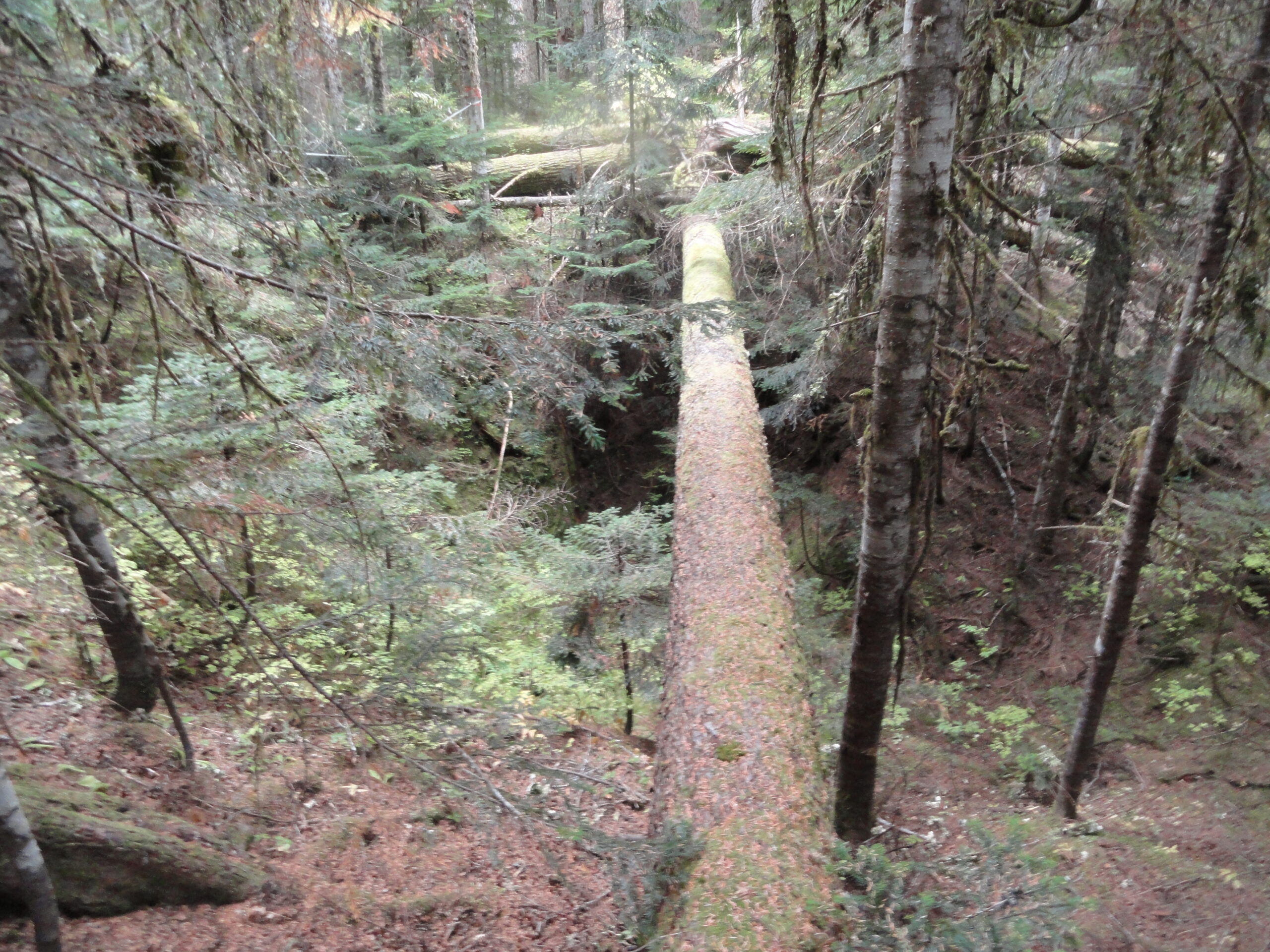
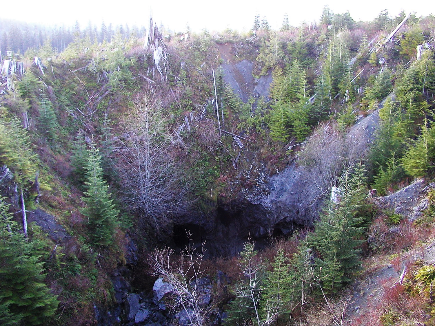
- Swallet – a point where a stream of any size sinks underground, forming (in some cases) a cave entrance (Figure 12.2.4),
- Dry valley – a linear valley that did (or occasionally does) contain a stream,
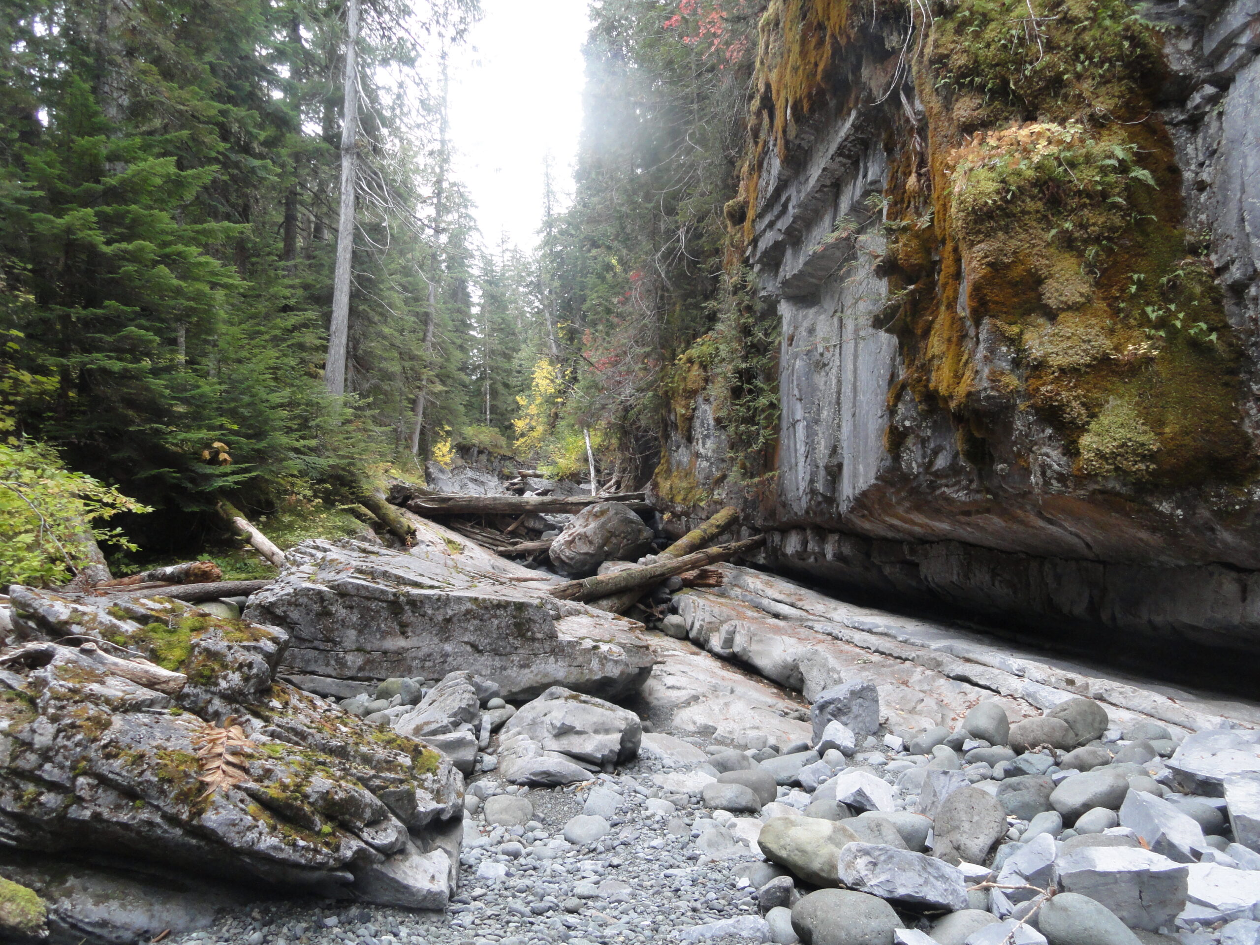
- Karst canyon – a steep sided canyon in karst with distinctive surface erosional features (e.g., scalloping),
- Karst spring – a site where an underground stream emerges from the karst bedrock and is sometimes the site for a cave entrance,
- Polje – a large flat bottomed karst depression with water flowing at the bottom,
- Grike – a linear, narrow, and deep slot formed by dissolution along a pre-existing fracture in bedrock, and
- Solution tube – a circular or elliptical, steeply inclined tube formed by dissolution.
In many cases several karst features can occur at the same site and can be nested within each other. These are termed compound karst features. For example, a sinkhole that acts as a swallet (with water that sinks into an opening), and this opening is a cave entrance (Figure 12.2.5). Trying to define what this feature is or to classify it into a scheme is problematic. The easiest way to deal with these features is to describe them by going from the outermost enclosing feature towards the centre. In the example above we have a sinkhole in which there is a swallet (or sink point), this sink point is in turn large enough to enter and is therefore a cave entrance! Other examples of nested features could include:
- Cave entrances along the base of a karst canyon.
- Springs and sink points along the sides of polje (large flat-bottom depressions).
- Swallets and springs along the base of a dry valley.
The Nature and Role of Epikarst
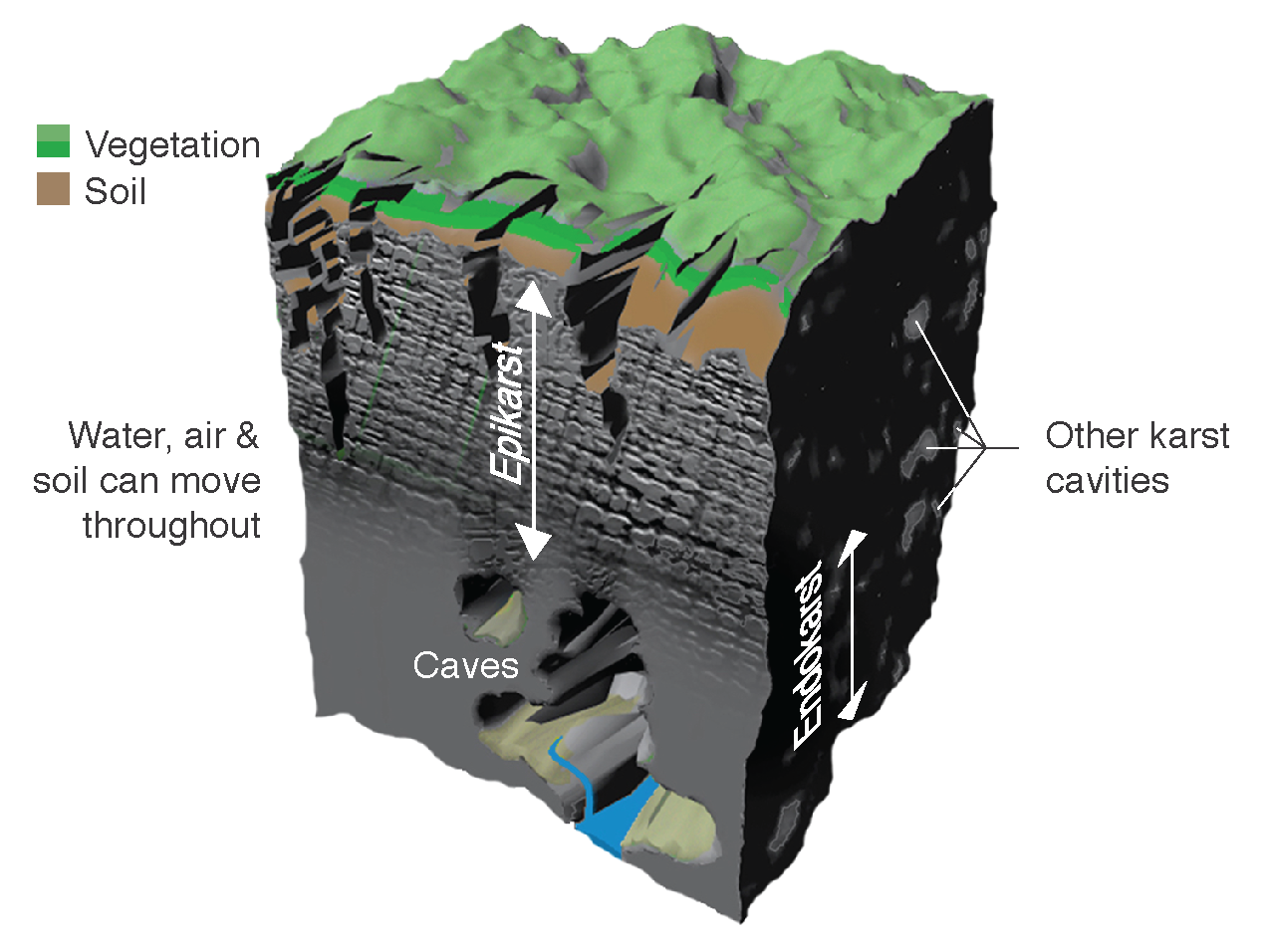
Another useful way to classify karst features in a landscape is by using the terms exokarst, epikarst and endokarst. These three terms are common in the karst literature and are of importance to the karst system as they help explain its three-dimensional nature (Figure 12.2.6). Exokarst is used to describe all features found on the surface of the karst landscape that range from the small-scale to large-scale (e.g., karren to sinkholes to poljes). Endokarst is used to describe all components of underground karst including the smallest cavities, cave formations, erosional features, and large cave passages. Epikarst is a zone of solutionally-enlarged openings or fractures that extends for up to 10-30 m below the surface and connects the exokarst to the endokarst. Epikarst is the zone where water, air, and other materials (sediment, organic debris, and nutrients) can be transferred from the surface to the subsurface. The epikarst zone is not always obvious but is usually present in some form or another. The thickness and level of the epikarst zone depends on factors such as: climate, precipitation rates, bedrock properties, time since last glaciation, elevation and relief, groundwater circulation, vegetation type.
Epikarst is the critical linkage between the surface and subsurface karst and has some important implications for karst hydrology and the management of karst landscapes (Figure 12.2.7). In terms of hydrology, it is the zone of karst that is responsible for collecting surface water by diffuse infiltration – whereby water percolates vertically through any openings in the bedrock and gradually enlarges them by solutional processes. These openings are usually larger near the surface and gradually diminish or close off at depth in the epikarst as the water typically loses its solutional power or aggressiveness as it percolates through the bedrock. This closing off effect can make the epikarst zone a site of temporary water storage, before directing or leaking water flow to the subsurface. The epikarst zone is also a habitat site for karst biota as it contains many of the karst biospaces that exist in the three-dimensional karst landscape. In many cases, particularly in glaciated areas such as in BC, the epikarst zone can be partially, or completely, filled with sediment. This material has either been injected during glacial events or during subsequent weathering. In some cases, this might reduce the rate of water percolation, unless compaction cracks or other opening forms in the sediment. It is also likely that this sediment (especially if disturbed) will gradually moves through the epikarst into the subsurface, in effect the karst is almost analogous to a landscape vacuum cleaner!
The concept of karst ‘openness’ or the connectivity within a karst system is a key factor controlling the degree and rate of changes that can occur between various components of the system. This openness is particularly important for any human development activities on surface of karst, whereby the epikarst zone can rapidly transport the materials into the underlying karst conduits and other subsurface cavities such as: water, nutrients, soil, organic debris, and pollutants.
Karst Sinkholes
Karst sinkholes are naturally enclosed funnel-shaped depressions that are the prime diagnostic features of a karst landscape (Figure 12.2.8). These features can range in size from a few meters in diameter up to a kilometer or so in size. In European literature karst sinkholes are typically called ‘dolines’. This term is used to distinguish karst sinkholes from those that can develop by other natural and man-made processes (e.g., collapse of abandoned underground mine workings). In this text the North American approach is used, and the term karst sinkhole is used for any funnel-shaped karst depression. Karst sinkholes typically have steep to subvertical sidewalls that can be a few metres to 100’s of meters deep. In cases where the karst surface is covered by surficial materials, sinkholes will still form, creating steep, and in some cases, unstable sidewalls.
In terms of hydrology, karst sinkholes can function as sink points for discrete streams (i.e., swallets), but can also act as sites of surface water concentration, whereby water falling onto the rim and sidewalls of a sinkhole flows toward the centre and base. It may help to think of karst sinkholes as vertical watercourses or upturned streams, as opposed to the horizontal watercourses on non-karst landscapes. This makes sense when you consider that most karst landscapes are typically devoid of surface water flow and that they are internally drained.
The three prime mechanisms by which karst sinkholes form are by solution, collapse, and suffosion. Solution sinkhole formation is where soluble bedrock dissolves at a point location, which then becomes a localized site for water concentration. This results in progressively more dissolution until a funnel-shaped feature or sinkhole is formed. This is the most common type of karst sinkhole. Collapse sinkhole formation is where the soluble bedrock falls into a cavity or cave below, forming a sinkhole with sub-vertical and fractured bedrock sidewalls (Figure 12.2.9). Suffosion is where loose soil materials are transported by gravity and water flow into cavities within an underlying karst layer. This results in the overlying soil materials forming funnel-shape sinkholes.
Media Attributions
- Figure 12.2.1 Photo by T. Stokes, CC BY 4.0
- Figure 12.2.2 Li Jiang Li River Guilin Yangshuo China by chensiyuan, CC BY SA 4.0, via Wikimedia Commons, https://commons.wikimedia.org/wiki/File:1_li_jiang_guilin_yangshuo_2011.jpg
- Figure 12.2.3 Photo by T. Stokes, CC BY 4.0
- Figure 12.2.4 Photo by P. Griffiths, CC BY 4.0
- Figure 12.2.5 Photo by T. Stokes, CC BY 4.0
- Figure 12.2.6 Exokarst, Epikarst and Endokarst by T. Stokes, CC BY 4.0)
- Figure 12.2.7 Photo by P. Griffiths, CC BY 4.0
- Figure 12.2.8 Photo by T. Stokes, CC BY 4.0
- Figure 12.2.9 Photo by P. Griffiths, CC BY 4.0
- Stokes, T. R., & Griffiths, P. A. (2019). An Overview of the Karst Areas in British Columbia, Canada. Geoscience Canada, 46(1), 49–66. https://doi.org/10.12789/geocanj.2019.46.145 ↵