Chapter 7 Volcanism
Learning Objectives
- Explain the relationships between plate tectonics and the formation of magma and volcanism,
- Describe the range of magma compositions formed in differing tectonic environments, and discuss the relationship between magma composition (and gas content) and eruption style,
- Explain the geological and eruption-style differences between different types of volcanoes, especially shield volcanoes, composite volcanoes and cinder cones,
- Understand the types of hazards, to people and to infrastructure, posed by the different types of volcanic eruptions,
- Describe the symptoms that we can expect to observe when a volcano is ready to erupt, and the techniques that we can use to monitor those symptoms and predict eruptions,
- Understand why so many humans have chosen to live near to volcanoes and some of the other attractions of volcanoes, and
- Describe some of the ways that volcanic eruptions contribute to Earth systems.
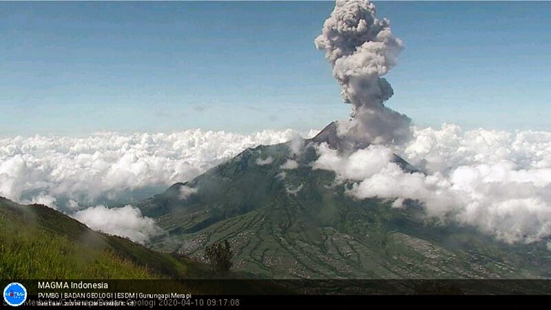
Indonesia has one of the greatest concentrations of volcanoes on Earth, and Indonesia’s most active volcano is Mt. Merapi, which started erupting again in December 2020 and continued into early 2021 (Figure 7.0.1). Mt. Merapi has had a significant eruption 74 times over the past 473 years, or once every 6 years on average. That is quite exceptional for a volcano of this type, most of which erupt only a few times a century, many much less than that.

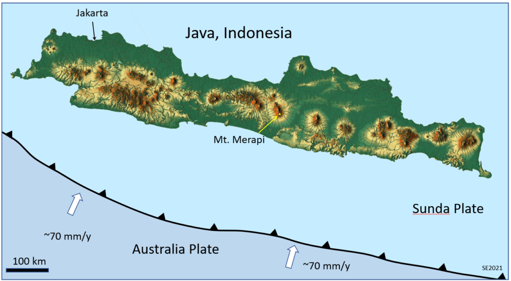
Mount Merapi is situated in the central part of the Island of Java, Indonesia (Figure 7.0.2), and it is one of over 20 volcanoes on the island. All of Java’s volcanoes are related to the subduction of the Australia Plate under the Sunda Plate and under Java. A described in Section 7.1, water from the subducting plate rises into the hot mantle rock beneath the overriding plate (in this case the Sunda Plate) and that leads to flux melting that produces the magma that feeds Java’s volcanoes.

- Figure 7.0.1 Mount Merapi Eruption, April 2020, Center for Volcanology and Geological Hazard Mitigation of Indonesia, https://magma.esdm.go.id/v1/gunung-api/gallery, CC BY-NC-ND 4.0
- Figure 7.0.2 Steven Earle, CC BY-SA 4.0, based on Java Relief map by Goren ek-en/OpenStreetMaps, via Wikimedia Commons, https://commons.wikimedia.org/wiki/File:Java_Relief_Map.svg CC BY-SA 4.0
